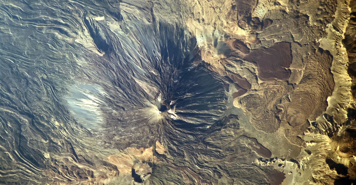
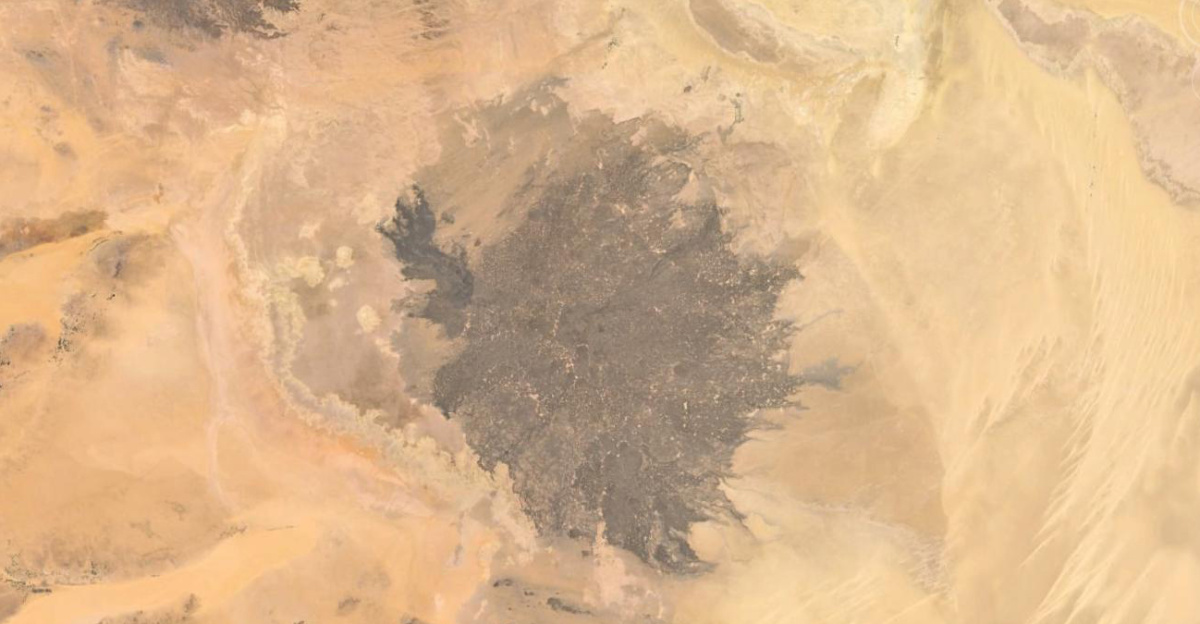
More than 150 extinct volcanoes concealed in the Haruj volcanic field, deep within Libya’s Sahara Desert, have been discovered thanks to NASA’s recent satellite imagery. In addition to redrawing North Africa’s geological map, this discovery demonstrates how sophisticated satellite technology can reveal geological features that are hidden from view. Tens of thousands of square kilometers make up the Haruj field, which serves as a sobering reminder that even the most desolate places can harbor hidden mysteries.
These findings pique scientific interest and promote a reconsideration of the Sahara’s arid past. Furthermore, this discovery highlights the vital role that remote sensing plays in modern earth sciences by establishing a precedent for using spaceborne instruments to reveal hidden geological phenomena on Earth and beyond.
Reconstructing Sahara’s Fiery Past
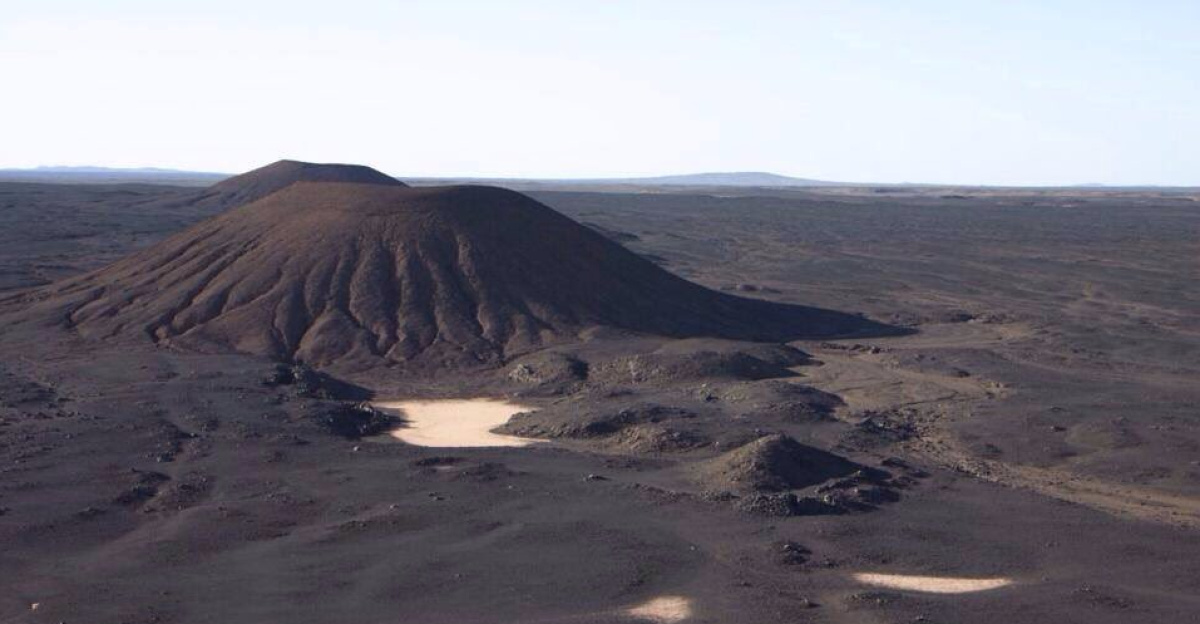
It may seem counterintuitive to recreate the Sahara’s fiery past volcanoes, but the region wasn’t always desolate and dry. The desert used to have rivers, lakes, and even luxuriant vegetation, according to geological evidence and satellite data. Mantle plumes penetrating the surface created the volcanic rocks of Haruj, which are the resilient remains of a six million-year-old era.
Our perception of the Sahara has evolved from a sea of dunes to a historical archive of fire and change as a result of these ancient eruptions, leaving a legacy hidden beneath shifting sands. Crucially, this reconstruction casts doubt on antiquated North African climate models and sheds light on the potential effects of volcanic activity on regional climate changes and biodiversity across geological epochs.
The Potential of Satellite Technology
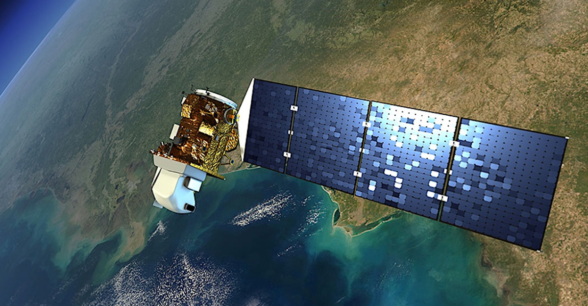
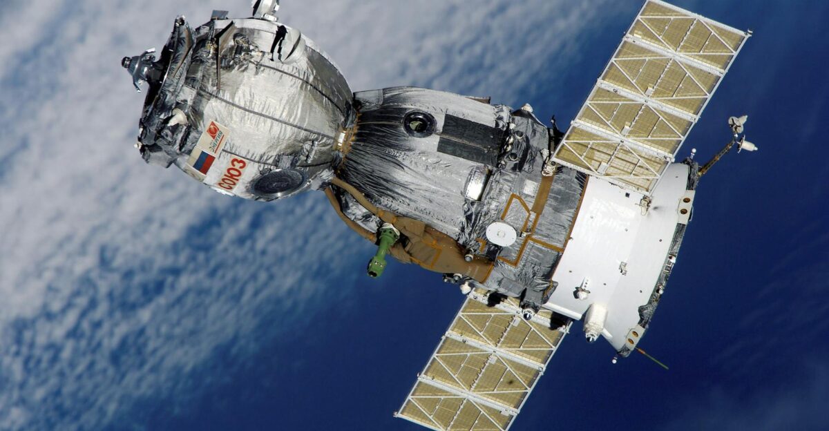
The claim that satellites are currently humanity’s most sophisticated geological investigators is not hyperbole. Even when hidden by desert sands, high-resolution sensors, such as those found in NASA’s Landsat and Sentinel-2 satellites, can identify volcanic cones, lava flows, and mineral compositions from space. Without a single boot touching the ground, these technologies allow for the discovery of enormous volcanic fields, surpassing the limitations of traditional fieldwork.
Global resource strategies are already being reshaped, and mineral exploration is being revolutionized by the combination of artificial intelligence and geospatial data. Furthermore, scientists can identify subtle spectral signatures of volcanic materials through multispectral and hyperspectral imaging, which improves geological mapping and guarantees more precise identification of hidden volcanic landforms across the globe.
Haruj: The Volcanic Heart of the Sahara
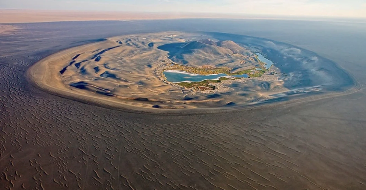
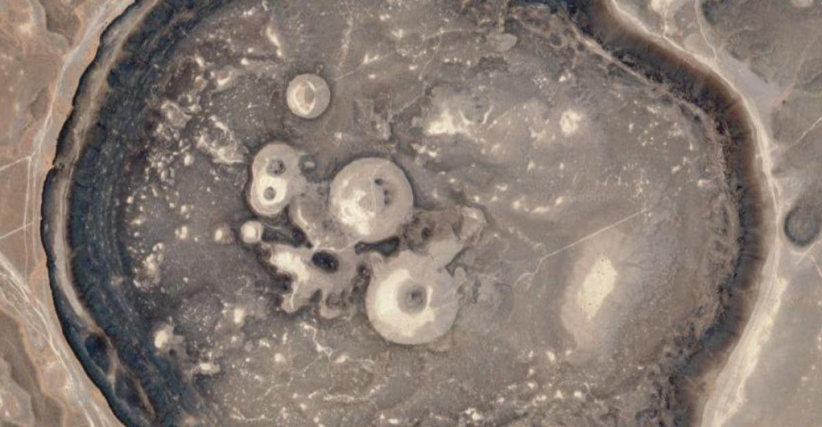
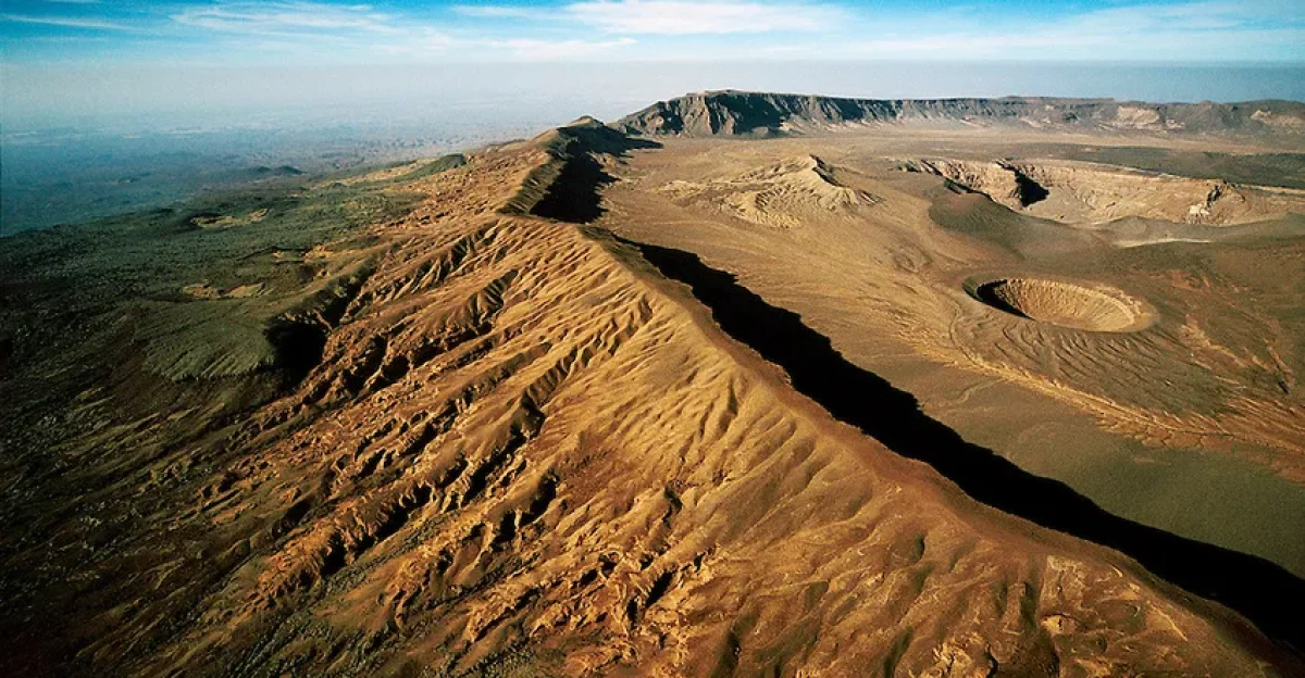
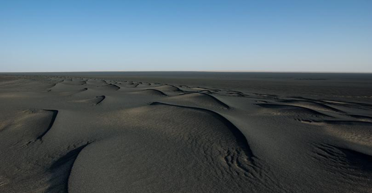
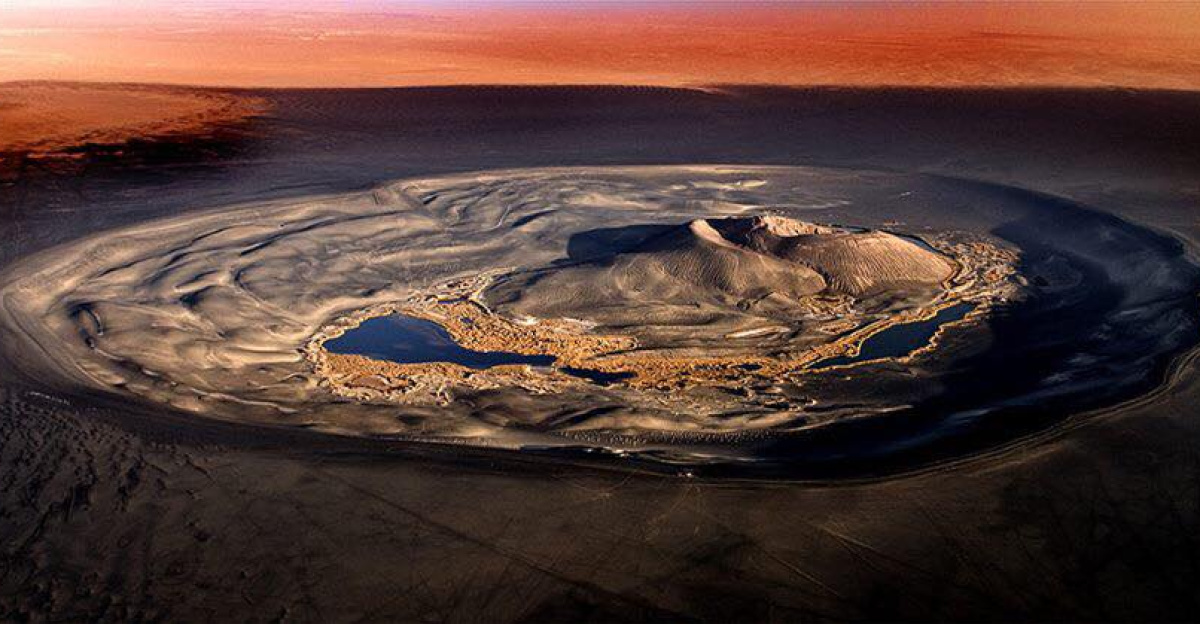
Haruj is an ancient battleground between the climates of the Earth’s interior and surface, making it more than just a geological wonder. It is a testament to cataclysmic activity, with over 150 cones and vast basaltic flows. From orbit, these extinct volcanoes look like a massive oil spill across Libya or an ink stain, so different from their desert surroundings.
Their existence suggests that the world, not just North Africa, was shaped by profound plate dynamics and tectonic processes. The sequence of mantle plume activities, tectonic uplift events, and erosion patterns that have shaped this landscape is also made more evident by in-depth studies of Haruj’s volcanic deposits, which encourage geologists to reevaluate long-held beliefs about the geological evolution of Northern Africa.
Similarities to Worldwide Volcanic Fields
With close counterparts in Saudi Arabia, East Africa, and even Mars, the Haruj discovery adds to the growing list of formerly undiscovered volcanic fields around the world. The extinct state of Haruj offers both exceptional stability and a geological time capsule, while the history of volcanic eruptions in places like the East African Rift is still changing.
The size and preservation of Haruj’s volcanic past set a new standard for comprehending planetary volcanism when compared to locations such as the Harrat Rahat or the Afar region in Ethiopia. Furthermore, researching Haruj in conjunction with Martian counterparts improves cross-planetary geological models, impacting theories of volcanic evolution, crust formation, and possible extraterrestrial life habitats.
Ecological and Environmental Effects
In equal measure, volcanic eruptions have always been both creators and destroyers. After initially devastating impacts, ancient ash and lava in the Sahara once reshaped local ecosystems and enriched soils with minerals. The legacy of such eruptions can last for millennia, impacting vegetation, water retention, and even the formation of hydrocarbons, according to recent research.
These influences have shaped the current desolate terrain over time, serving as a reminder that the desert of today was once teeming with life. Furthermore, modern restoration ecology and desert agriculture projects that aim to revitalize degraded soils for sustainable land use can benefit from an understanding of volcanic soil dynamics in arid regions.
The Resource Perspective on Economic Potential
Beyond the realm of pure science, the discovery that satellites can reveal hidden volcanoes has immediate ramifications. Rich mineral deposits, ranging from rare earth elements to gold, can be found in volcanic terrain. Exploration is booming in previously unreachable areas thanks to advanced satellite mineral mapping that uses hyperspectral imaging.
Places like Haruj are now seen by businesses and countries as potential economic engines that are ready for responsible exploitation, rather than just as geological oddities. In a strategically significant region like North Africa, it also brings up pressing issues regarding indigenous land rights, the geopolitical ramifications of mineral wealth, and striking a balance between resource extraction and environmental stewardship.
Early Warnings and Remote Sensing
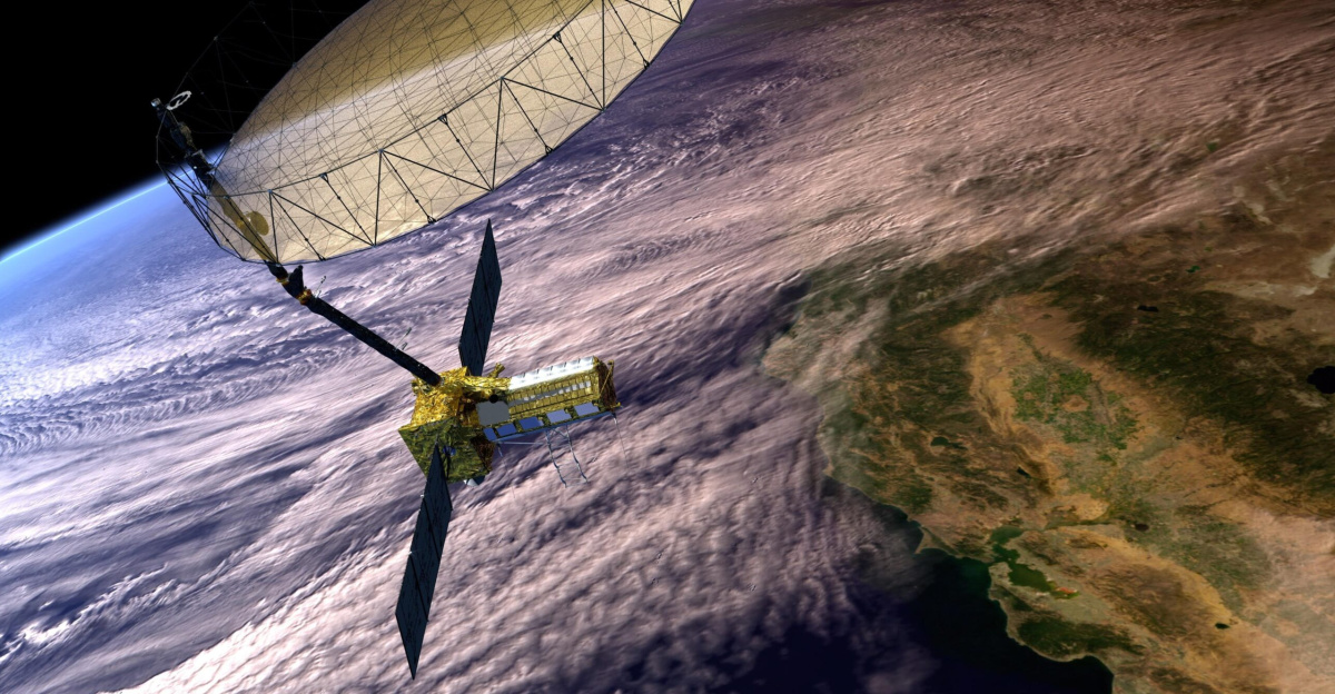
Satellites are essential tools for anticipating geological hazards, not just for making historic discoveries. NASA’s sensor suite serves as an early warning system for possible eruptions by tracking variations in volcanic ash, thermal emissions, and even the color of tree leaves.
These technologies could be modified to monitor subsurface activities elsewhere, including the dormant fields of the Sahara, providing vital safety and research data in real time. Beyond Earth’s deserts, this proactive monitoring capability informs disaster preparedness in volcanically active zones worldwide and exemplifies the critical role that satellite surveillance plays in mitigating natural hazards.
Human Adaptation: Historical Perspectives
The Sahara’s hidden volcanoes serve as a reminder that geology, climate, and civilization are all intertwined. Volcanic activity occasionally made it easier for people to settle in North Africa by producing fertile plains and oases during the region’s oscillation between humid and arid periods.
Strategies for contemporary adaptation in marginal environments threatened by resource scarcity and desertification could be informed by knowledge of these ancient cycles and how volcanic soils sustained past human life. By bridging geology with anthropology, archaeology, and environmental planning, this knowledge allows for more comprehensive approaches to reducing the effects of climate change and building resilient human ecosystems in arid areas.
From a Psychological Standpoint: The Unknown in Plain View
A profound psychological blind spot, the propensity to assume that what is visible is all that exists, is also revealed by this discovery. The “discovery” of the Haruj field serves as a reminder that outdated ideas, not a lack of technology, are frequently the cause of collective ignorance.
This cognitive bias promotes constant reevaluation of our surroundings, even in ostensibly well-mapped regions, and it permeates business, policy, and science. The lesson is that genuine innovation requires the courage to challenge presumptions. This idea also has wider ramifications for how societies view risk, knowledge, and decision-making in a time when complex, multi-layered data is becoming more and more prevalent.
Changes in Geological Theory Paradigms
The discovery of 150 volcanoes challenges accepted theories about the geology of the Sahara. For decades, the Sahara was depicted as geologically uniform, shaped mainly by wind and sand. It is now evident that its history includes tectonic reorganization, deep mantle plumes, and recurrent volcanism.
This necessitates revising models and textbooks, which forces geologists to look for signs of volcanic activity in other “featureless” deserts across the globe. As satellite resolutions and AI-powered analyses advance, more surprises should be in store. This new paradigm challenges our understanding of how deserts change geologically over millions of years and supports a more dynamic, interconnected knowledge of Earth’s lithosphere.
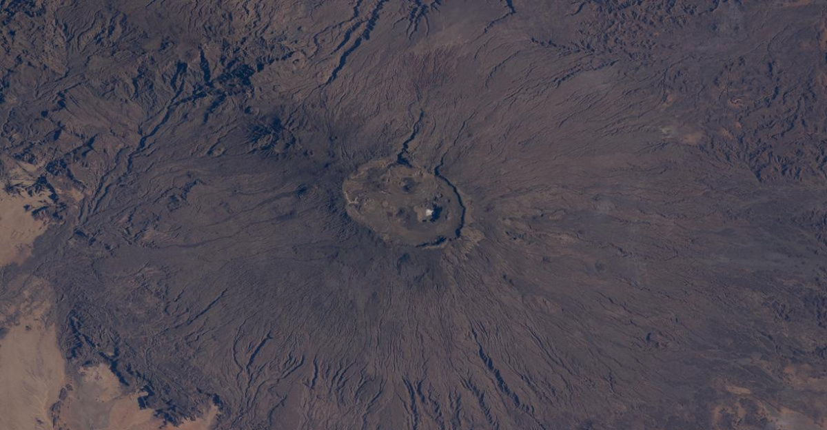
The Mashup of Planetary Science and Martian Analogue
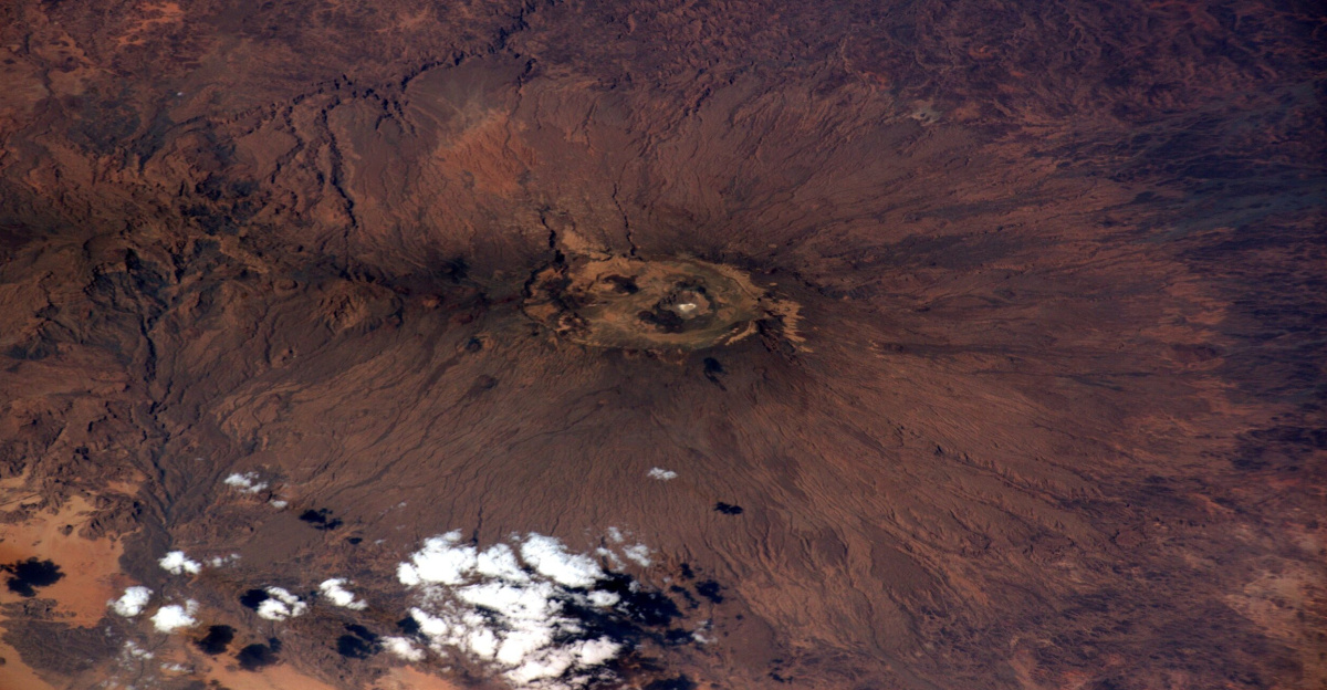
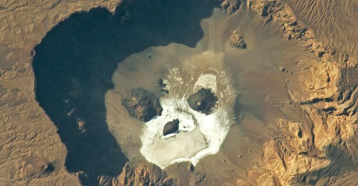
Researchers have discovered remarkable parallels between the volcanic formations on Haruj and those on Mars. The highest point in the Sahara, Emi Koussi, is comparable to Elysium Mons on Mars in terms of geology.
Researchers can directly understand how volcanic activity shaped other terrestrial planets by examining features revealed by satellites in Libya. This information informs both planetary science and the search for extraterrestrial life. The importance of terrestrial analogs in enhancing rover mission targets, deciphering Martian geology, and broadening our knowledge of planetary habitability beyond Earth is highlighted by this interdisciplinary approach.
Doubt and Contrarian Views
Not everyone is prepared to change the history of the Sahara. Skeptics contend that satellite discoveries run the risk of being misclassified in the absence of thorough field verification. These uncertainties, however, are decreasing every day due to the increasing precision and cross-validation of orbital data.
Now, the actual question is not “is it there?” but rather “how did we miss it for so long?” This calls for a much-needed examination of scientific complacency and biases in data interpretation. This skepticism promotes strong interdisciplinary fieldwork, stringent peer review, and openness in the interpretation of satellite data, all of which are beneficial to scientific rigor.
A New Era of Discovery
Finding lost volcanoes is a journey, not a destination. This success story will encourage international exploration partnerships, spur additional funding for orbital geology, and transform the way that desert landscape education is taught. In order to use ancient geological processes to inform future sustainability strategies, the cascade effects could include a resurgence of interest in desert agriculture, mineral extraction, and even climate engineering modeling.
Anticipate a revival of multidisciplinary “desert science,” propelled by findings such as the volcanic field at Haruj. Technology developments, policy discussions, and cultural narratives focused on comprehending Earth’s least hospitable environments as crucial scientific reservoirs will probably be sparked by this.
Knowledge in the Sands
There are far-reaching scientific ramifications to the abrupt exposure of 150 extinct volcanoes in the center of the Sahara. It casts doubt on our presumptions, changes the course of geological history, and emphasizes how satellite technology can reveal the invisible.
From planetary analogs to psychological insights, from ecological resilience to economic opportunities, this discovery is both an invitation and a wake-up call. The Sahara is now more than just a desert; it is a repository of Earth’s rich past, waiting for those who have the courage to look past the sand. In the end, this is a reminder that there are many hidden phenomena on Earth and that humanity can only fully comprehend its intricate, dynamic systems by persistent exploration and unbiased inquiry.