A forgotten Roman town, hidden for nearly 2,000 years beneath Cambridgeshire’s soil, has been rediscovered. Unearthed during the planning stages of a solar farm near Great Staughton, this remarkably well-preserved site spans 31 hectares, providing fascinating clues about life in Roman Britain.
Historians and archaeologists now dig away layers of the past to reveal secrets hidden beneath centuries of farmland. With increasing archaeological evidence, the site presents an extraordinary opportunity to study and reconsider everything we thought we understood about the Roman occupation of Britain.
Could this quiet field rewrite Roman urbanism, trade, and technological advances textbooks and what secrets might enthusiastic archaeologists find in the dirt?
Digging up an Entire Town
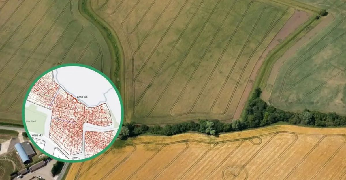
First spotted by aerial crop marks in 2009, this Roman town remained rather obscure until geophysical surveys in 2019 confirmed its significance. Located just beyond Great Staughton, Cambridgeshire, the site was initially set aside for a solar farm run by Brockwell Energy.
But when archaeologists found roads, pits, and buildings, things quickly changed. Historic England intervened, providing legal protection in 2024 and halting commercial development, and making the site a scheduled monument.
With 31 hectares of settled land laid out beneath the ground, experts claim it might be one of the most detailed images of Roman town planning ever found in rural east England.
Merging Technology and Heritage
The site’s excavation and conservation were made possible by cutting-edge equipment that’s reshaped the archaeology field. Aerial drones, geophysical surveys, and satellite imaging brought the site to light after being hidden for centuries.
Today, advanced technologies are being used to bring the town to life. Imagine VR tours along its streets, AI-driven artifact cataloguing, and real-time soil chemistry sensors monitor preservation.
Cross-disciplinary collaboration between architecture, computer science, or game design can make Roman towns interactive sites for learning. This isn’t science fiction. The future of heritage education and wonder is no longer served by static museums; it demands living digital worlds.
Educational and Research Opportunities

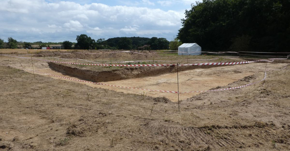
With the site so well-preserved, archaeologists now have an unspoiled canvas to examine. Future digs will likely use non-destructive techniques—like LIDAR, magnetometry, and 3D ground-penetrating radar—to image and model the town as a whole.
It could be a model for open-access archaeological research, where crowdsourced artifact analysis can allow citizen scientists to get involved. Further, the site can serve as a great educational tool. Universities can run field schools, engaging students in real digs, and virtual tours can bring Roman history into classrooms.
This isn’t just studying crumbling rubble, it’s an opportunity to expand the way we learn from and about ancient societies.
Constraining Historical Assumptions

Until now, historians believed that Roman settlements in this region were sparse, with bigger settlements like Cambridge dominating the narrative. However, this site forces us to reconsider our previous assumptions.
Its scale and complexity are matched by more well-known urban centers, proving that Eastern England was more Romanized than we thought. In this site, we see civilian planning, commercial variety, and technological diffusion.
It may also disprove the theory that the end of Roman Britain was marked by catastrophic collapse, suggesting a progressive change rather than apocalyptic disintegration. So, what other secrets does this site reveal abo
ut an important part of history?
A Glimpse into Roman Urban Planning
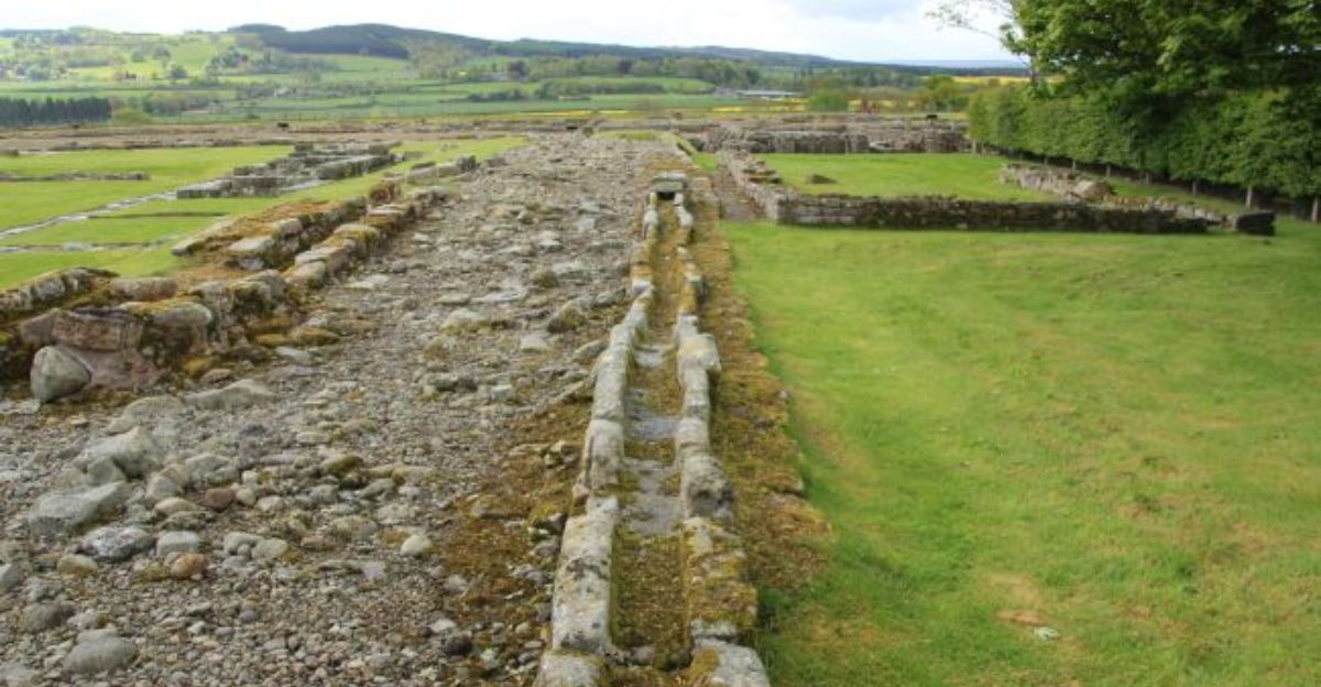
The site reveals a deliberately planned Roman settlement with a central open space—likely a forum or market—surrounded by streets. These intersecting roads form a grid of rectangular plots, suggesting zoning for different uses: homes, workshops, and warehouses, etc.
Unlike the chaotic expansion seen in some Roman cities, this one has a more methodical layout. Such planning suggests centralized control, civic awareness, and even Romanized governance. Urban grids were not just attractive; they were tools of empire, imposing order.
The Cambridgeshire layout corresponds with other discovered towns such as Verulamium (St Albans), which suggests that this was not a haphazard outpost, but rather an organized Roman civic space.
Industrial Activity and Economic Insights

Aside from infrastructure, evidence of industry is everywhere. Excavations revealed kilns, blacksmithing areas, and workshops that suggest productive local manufacturing. Pottery fragments, iron tools, glass pieces, and copper objects point toward busy artisans creating goods for commerce.
Its proximity to Roman roads and waterways emphasizes the town’s position as a small economic hub, and the presence of coins from the 2nd and 3rd centuries CE indicates ongoing activity.
Further, animal bones and shellfish found on site points towards agriculture and trade networks reaching the coast. Far from being a backwater outpost, the town was economically integrated, with connections to the broader Roman economy while sustaining local livelihoods.
Environmental Adaptation and Resource Management

Roman engineers didn’t just build towns either, they modified their landscapes. This is an example of sophisticated environmental adaptation. Situated on drained land near tributaries, entering the River Kym, the town likely had water management systems.
Archaeologists believe that water was diverted in order to facilitate industrial processes like kilns for ceramics or domestic water needs. Above the site lies a Roman villa, possibly housing an estate owner or administrator who oversaw local affairs.
The gradation of space between town and villa provides insight into Roman ideals of class and domination. Unlike modern rural sprawl, the site is an example of environmental domination for productivity and social distinction.
Preservation Amid Modern Development

Initially, this land was set to be a 120-hectare solar farm. When the settlement was discovered and later confirmed, Brockwell Solar cooperated with Historic England and re-drafted their proposals, taking out 31 hectares and rezoning it as heritage pastures.
The action highlights an unusual but inspiring collaboration: tech-driven green development and historic conservation. Such collaborations don’t happen often but should.
However, this leaves a profoundly significant question: Must we compromise between heritage and sustainability? Here, a carbon-neutral future did not equate to the erasure of the past. Instead, the project now emphasizes responsible, forward-looking, and heritage-conscious progress.
A Testament to Cooperative Stewardship

This Cambridgeshire site is an example of a modern parable of coexistence. It shows how archaeologists, developers, government bodies, and the public can cooperate. Instead of letting a renewable energy scheme bulldoze history, stakeholders intervened, saved it, and then progressed.
This unprecedented collaboration helped reveal secrets hidden for over 2,000 years under farmland. The Roman Britain town wasn’t just a small settlement, it was a thriving, functioning economic hub not unlike our smaller villages today.
As the site is excavated further, history might be rewritten once more, forcing us to reconsider our past and look to the future of historical conservation.