As an American, when you leave your house in the morning, you aren’t expecting a giant dust cloud to come your way and affect your whole day, right? It sounds like a fictional scenario, but for a few states in the U.S., this will be a reality in no time. A colossal plume of dust, all the way from the Sahara Desert, is set to blanket the region in a thick haze, turning skies into a haze and impacting air quality across multiple states.
Will you be affected by this historic dust storm or be lucky enough to only read about it online?
How the Storm Began
This storm is nothing out of the ordinary for the Sahara Desert and is more common than you might think. Strong surface winds, often generated by outflows from thunderstorms and known as haboobs, sweep massive quantities of loose sediment into the atmosphere. Meteorological conditions intensify the winds, allowing the dust to rise high into the atmosphere and form a colossal plume.
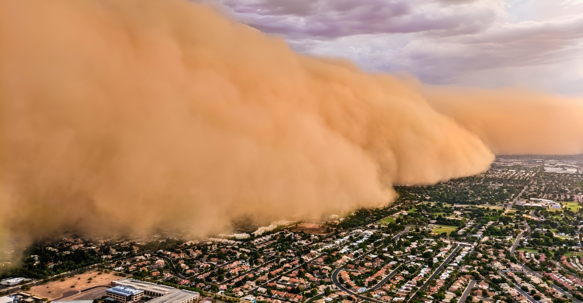
When a thunderstorm collapses, cold downdrafts rush outward, sweeping up loose dust and sand from the ground to form a dense, advancing wall of airborne particles that can stretch for miles.
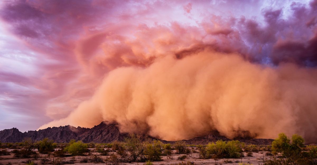
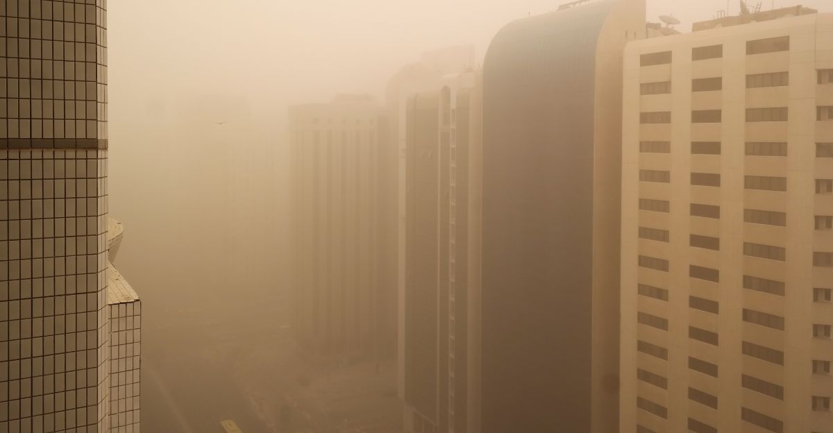
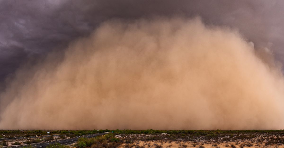
What Is a Haboob?
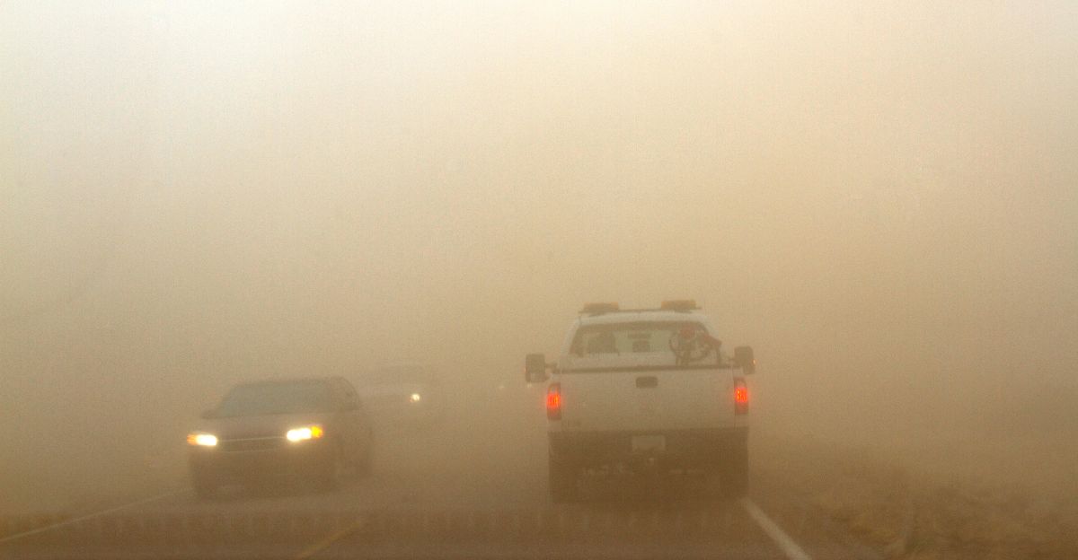
A haboob is an intense dust storm characterized by a towering wall of dust and debris propelled by strong winds, typically generated by the outflow of a thunderstorm or weather front. Haboobs often arrive suddenly with little warning, bringing gusty winds reaching 22 to 62 mph speeds.
“Haboobs result from a microburst – an intense column of sinking air within a thunderstorm, which, as it hits the ground, spreads out in all directions and carries sand or dust particles at speeds of up to 60 miles per hour,” the Royal Meteorological Society explains. “The lofted particles can reach 5,000 feet and extend up to 100 miles wide.”
A Journey Across The Ocean
After being lofted high into the atmosphere by powerful winds, the dust forms part of the Saharan Air Layer, a dry, dusty air mass that rides the trade winds westward across the Atlantic Ocean. While much dust remains suspended high in the atmosphere, it can still create hazy skies, vivid sunrises, and sunsets. It can even suppress hurricane formation by introducing dry, stable air into typically storm-prone regions.
“Haboobs happen all over Africa. This is a grand-scale haboob,” said Jason Dunion, a hurricane scientist at NOAA. “It’s about the size of the lower 48 states, and it contains a lot of dry air and a lot of dust, as well. And it makes its way completely across the Atlantic. It’s traveled about 4,000 miles so far.”
Where and When Will It Hit
This historic Saharan dust storm is expected to arrive in early June 2025, with the thickest concentrations expected to impact the Gulf Coast and southeastern United States throughout the week. After blanketing the Caribbean, including Cuba, Haiti, and Puerto Rico, the dust plume is forecast to reach southern Florida by June 4, spreading northward across the state and into Georgia, South Carolina, Louisiana, Mississippi, Alabama, and Texas.
“This is the biggest Saharan dust plume that we’ve seen so far this year. It is very common to see large plumes of Saharan dust coming across the Atlantic toward the United States in June and July,” said AccuWeather Lead Hurricane Expert Alex DaSilva. “Many people will notice more colorful sunrises and sunsets, and a milky or hazy look in the sky.”
Impact on Weather and Hurricane Season
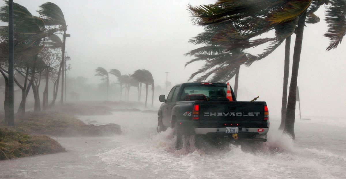
The Saharan Air Layer, rich in dust and dry air, is a natural suppressant for hurricane formation by introducing several key atmospheric changes. First, the dust absorbs and scatters solar radiation, making cooler sea surface temperatures less favorable for hurricane development. These storms decrease the likelihood of storm formation and can explain periods of unusually quiet hurricane activity.
“Significant amounts of dust can inhibit tropical storm formation, or the strengthening of an existing system, because the dusty air has about 50% less moisture than the typical tropical atmosphere.” wrote Jesse Ferrell, AccuWeather meteorologist and senior weather editor.
Tracking the Storm
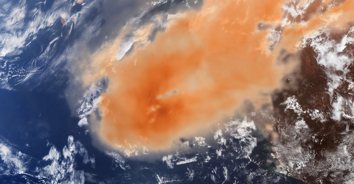
With a storm this size, it is no surprise that researchers are closely monitoring it to see exactly where it’s heading. Two satellites, Copernicus Sentinel-3 and Sentinel-5P, are being used to monitor every move this storm makes. Sentinel-3 captures detailed optical images of the dense, orange dust plume traveling across the Atlantic. At the same time, Sentinel-5P’s Tropomi instrument measures aerosol concentrations, keeping an eye on the dust’s thickness and composition.
“Sentinel-5P is an important tool to monitor air pollution,” said European Space Agency (ESA) scientists. “It helps us understand how airborne particles affect people and ecosystems.”
Air Quality Concerns and Health Risks
Anyone who suffers from allergies will cringe when they hear the word dust, and a dust storm of this size will affect many people. Exposure to Saharan dust has been linked to exacerbations of asthma, chronic obstructive pulmonary disease (COPD), and other lung diseases, as well as increased rates of respiratory symptoms like coughing, wheezing, and shortness of breath.
Epidemiological studies have documented rises in hospital admissions and emergency room visits during dust storm episodes, especially among sensitive groups. “People with asthma and older adults tend to be more vulnerable during these dust events,” said Hurricane researcher Jason Dunion.
Not Unusual, but Remarkable
Although this dust storm is among the largest to hit the U.S., the phenomenon itself is far from unusual. Each year, millions of tons of Saharan dust are swept across the Atlantic by seasonal winds, with plumes regularly reaching the Caribbean, the Gulf Coast, and even as far north as the eastern United States.
The dust delivers essential nutrients like iron and phosphorus to the Amazon rainforest and Atlantic Ocean, supporting plant growth and marine productivity. What makes the current event so remarkable is its sheer size and density, leaving researchers in awe of its capabilities.
More Dust on the Horizon
As remarkable as this historic dust storm is, it is not the last Saharan plume expected this season. Meteorologists emphasize that Saharan dust outbreaks are recurring from late spring through mid-summer. New plumes form every few days and ride the trade winds across the Atlantic. They might not be as large as this beastly plume, but they will show face now and then.
The ongoing movement of Saharan dust reminds us that while individual storms may capture headlines, the phenomenon is part of a broader seasonal cycle that will continue to shape the weather around the world.