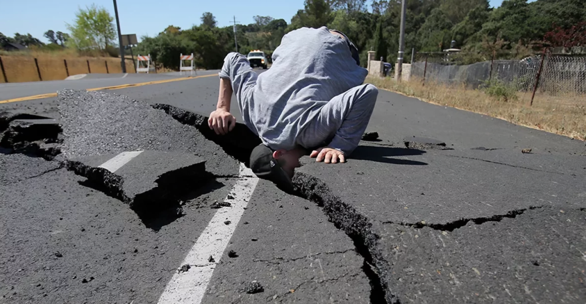
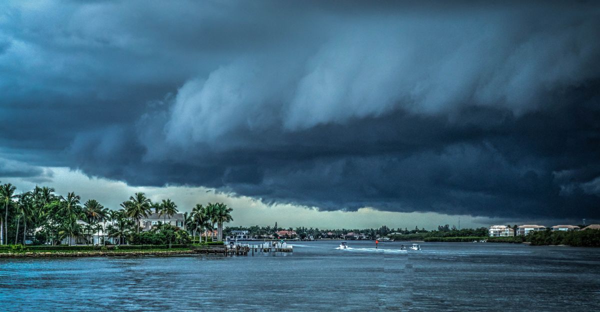
You might think that having a once-in-a-thousand-year storm once in your life is remarkable, but for some states in the U.S., they had quite a surprise when they were hit by multiple storms less than weeks apart. These storms, which statistically have just a 0.1% chance of happening in any given year, happened within days of one another and were devastating.
These events have signaled a worrying escalation in the frequency and severity of extreme rainfall, challenging our assumptions about climate stability and resilience. Is there a reason these 0.1% storms happened so often and close together?
What Is a 1,000-Year Storm?
Despite the name, it doesn’t mean that a storm like this happens only once every thousand years; instead, it’s a statistical way of expressing the rarity based on historical weather data and probability. With climate change, these so-called “1,000-year” events are happening more often, making them more concerning than ever before.
“The probability is 0.1% for your location each year, so it’s very unlikely to occur where you are, but over an entire country, some of them are going to happen somewhere each year,” said Russ Schumacher, director of the Colorado Climate Center at Colorado State University and the state climatologist.
States That Were Hit the Hardest
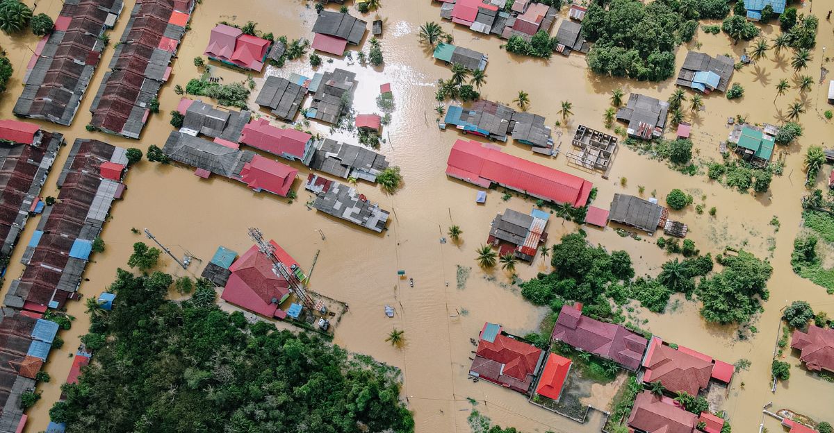
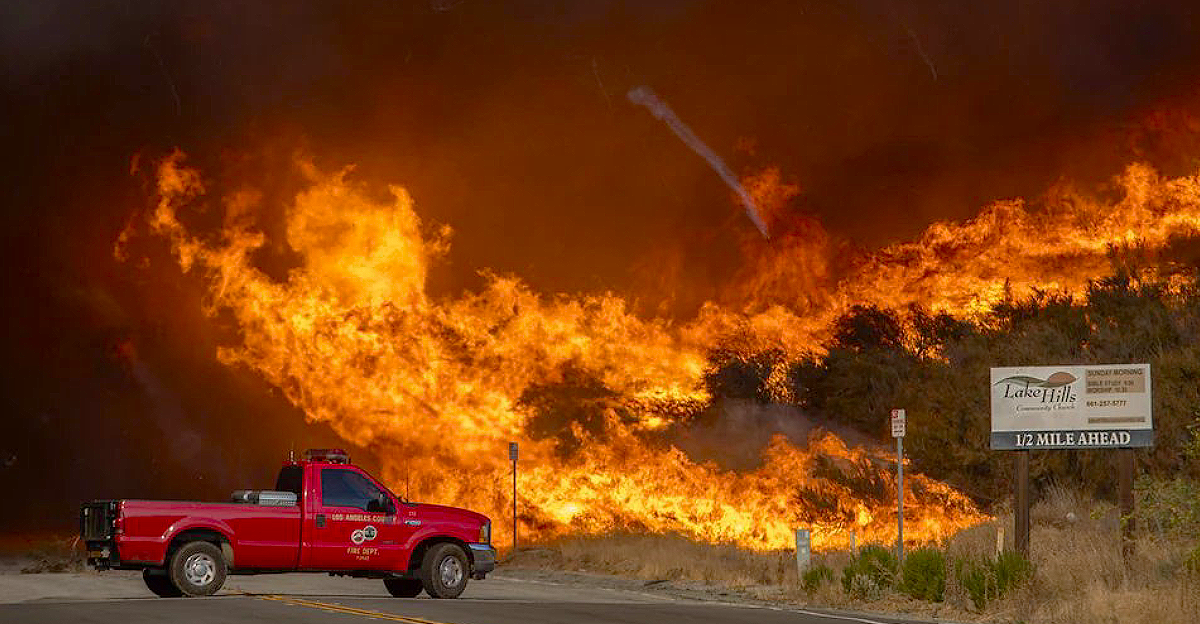
The devastating series of 1,000-year storms in July left quite a mark on three states, particularly Texas, North Carolina, and Illinois. In Texas, intense, slow-moving thunderstorms soaked central regions with more than a summer’s worth of rain in mere hours, causing the Guadalupe River to surge over 20 feet in just 90 minutes and resulting in over 120 fatalities across the Hill Country.
Days later, what was left of Tropical Storm Chantal battered central North Carolina, flooding towns like Chapel Hill and Siler City with up to a foot of rain. Illinois was struck soon after, with five inches of rain falling in less than two hours over Chicago’s Garfield Park, overwhelming drainage systems and prompting rescue operations as homes and streets rapidly filled with water.
“These events come and go in the news, and before you know it, we’re on to the next one,” said Kristina Dahl, vice president for science at the nonprofit organization Climate Central. “It’s easy to forget that for the people experiencing this, it’s really a yearslong process of healing.”
The Texas Deluge
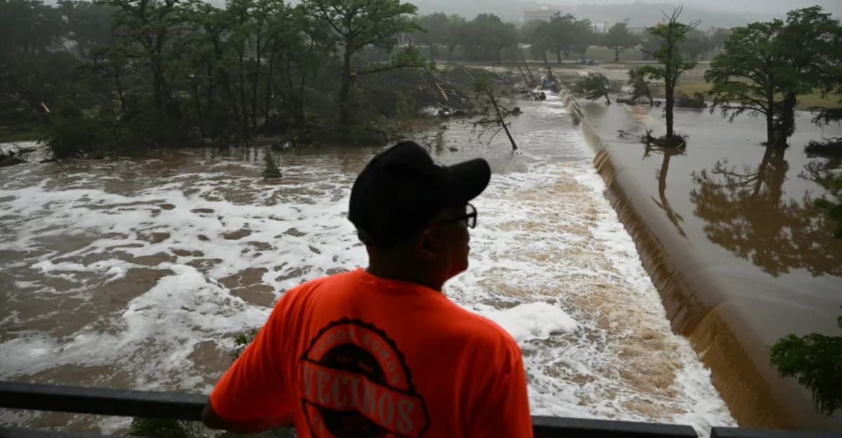
Just after midnight on July 4, 2025, a stalled storm system, supercharged by lingering moisture from Tropical Storm Barry, poured down masses of rain, dropping up to 20 inches in some areas in a matter of hours. In Kerr County, the water rose 26 feet in only 45 minutes, flooding entire neighborhoods, strands of summer camps, and RV parks.
Tropical Storm Chantal Hits North Carolina

Tropical Storm Chantal devastated central North Carolina, landing just after the July Fourth weekend. Making landfall near Litchfield Beach, South Carolina, Chantal quickly moved inland and unloaded a deluge across the Piedmont and Sandhills. Rainfall in some areas reached 9 to 12 inches within a day, causing record-breaking floods on rivers such as the Eno and Haw.
Governor Josh Stein declared a state of emergency for 13 counties to facilitate federal recovery aid as torrential rain and subsequent storms battered already reeling communities.
Rainfall Submerges Chicago
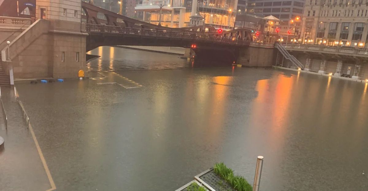
On July 8, Chicago had intense rains, and in just 90 minutes, neighborhoods west of the United Center saw over five inches of rain, surpassing the city’s typical total for the entire month of July. Garfield Park reported an astonishing 5.45 inches in under three hours, with other areas near the Loop receiving close to four inches in under two hours.
Major roadways such as the Kennedy and Eisenhower Expressways faced closures, and flash flood alerts triggered city-wide emergency responses.
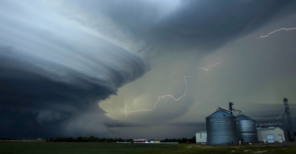
The Science Behind the Storms

Scientists point to several factors, like unusually warm ocean temperatures, particularly in the Gulf of Mexico and western Atlantic, that have provided extra fuel for tropical systems like Chantal. The stalled weather patterns that triggered these events, including persistent high-pressure “blocking” systems, caused slow-moving storms that dumped extraordinary amounts of water over the same areas for hours. Meteorologists also note that warmer air can hold more moisture, so when storms form, they have increased potential to release historic rain totals.
“It is a mathematical certainty that as the atmosphere holds more water, it can also discharge more water in an instantaneous fashion,” said Dave Gochis, a hydrometeorologist, head of prediction services at Airborne Snow Observatories.
New York Following in the Footsteps
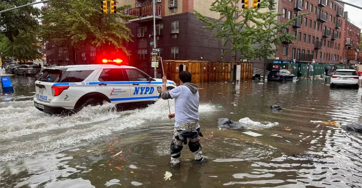
On July 14, 2025, New York City experienced some of its most intense flash flooding in years. Central Park recorded 2.07 inches of rain within a single hour, marking the second-highest one-hour total ever measured at that location, surpassed only by Hurricane Ida in 2021. Emergency management officials launched city-wide responses, activated flood warning systems, and urged residents to seek safety and be ready to evacuate immediately.
“As climate change increases the number and severity of extreme rainfall events the city is experiencing, we are doing things like increasing the number of trees in the city to reduce stormwater and using the latest available climate science and data to inform our infrastructure projects,” said Mayor’s Office of Climate & Environmental Justice Executive Director Elijah Hutchinson.
The Increase of Flooding Events
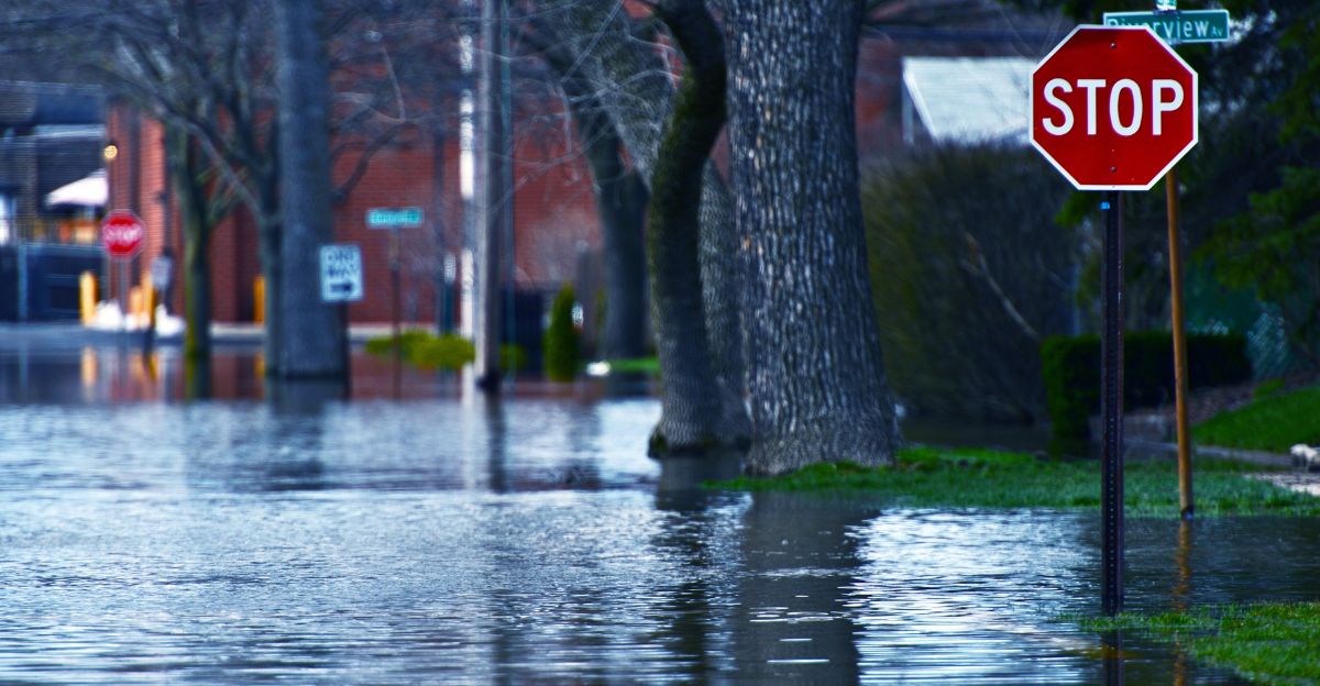
Extreme rain events, once expected only once in a millennium, are now recurring far more frequently. Recent data shows that over 3,000 flash flood warnings were issued across the U.S. in the first half of 2025 alone, the highest recorded total.
Scientists project that extreme rainfall events once considered rare will become far more common. What used to be century-scale floods could potentially occur every few decades, and their intensity could increase by up to 20% or more if current warming trends continue.
A Nation on Edge

Americans across regions and political divides are confronting the sobering reality that what was once “unthinkable” is now increasingly routine. Polls show a majority expect extreme weather to become even more frequent in the coming years, with public concern rising for personal safety. In Texas’ Hill Country alone, catastrophic flash flooding claimed the lives of over 120 people, including dozens of children at a summer camp, while states like North Carolina, Illinois, New Mexico, and New York saw additional fatalities as relentless rain overwhelmed communities. Not only will it take years for communities to recover from the losses they face, but the financial impact is equally profound.